Hello from Manchester UK
Posted: Thu Jan 18, 2018 4:32 pm
Hello all,
I've recently purchased OWM in order to design a map for a board game. I also took a look at Campaign Cartographer, but OWM looked a bit more modern so chose to purchase that instead.
The map I wanted to create is set in Ancient Rome so I followed this great tutorial to import data from Natural Earth https://www.otherworldmapper.com/blog/t ... -data-shp/
I'd like to say thank you for the support on the forum and blog post to help create this map. Here's the finished result.
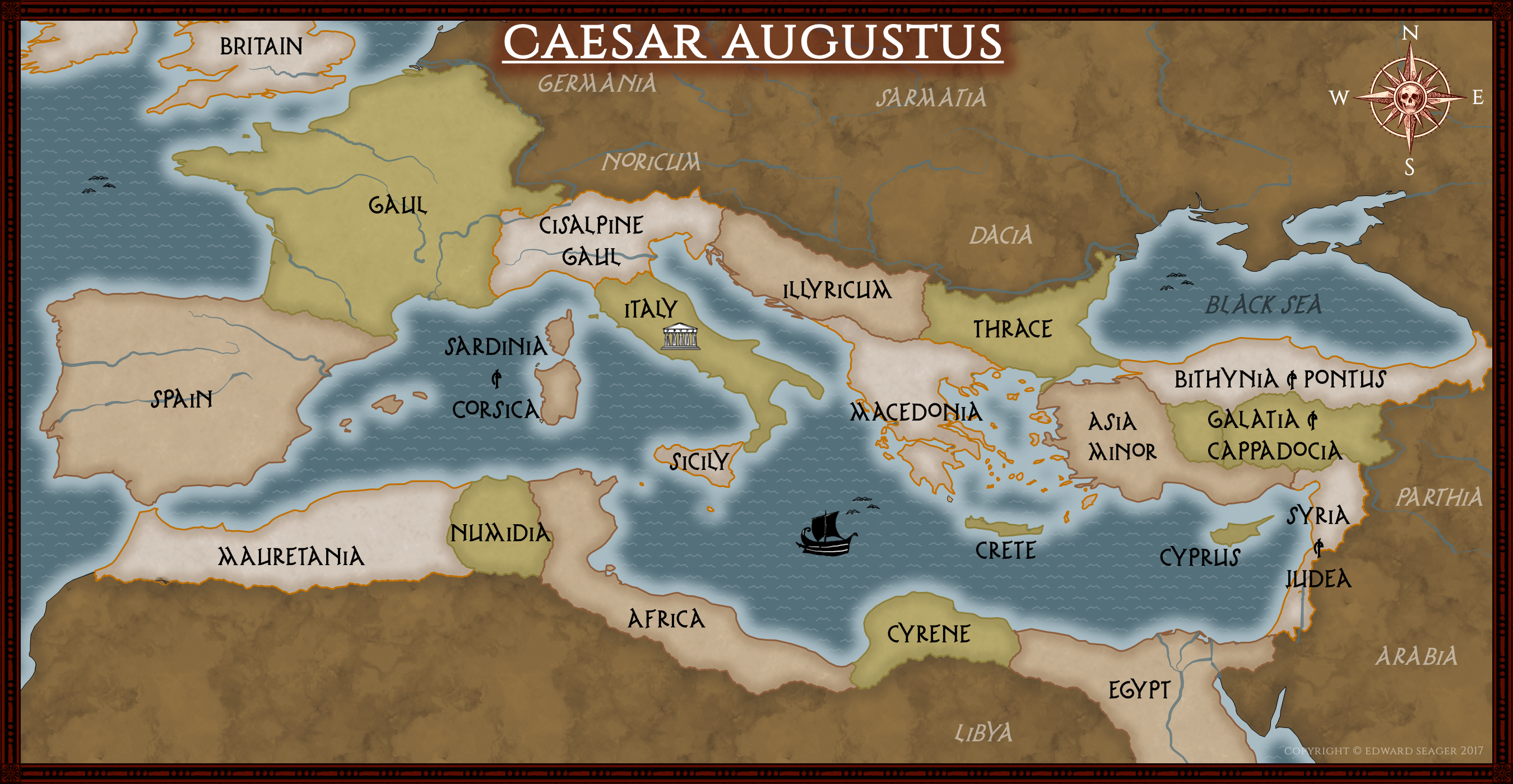
I found it very easy to change the colours and textures on OWM. What was more tricky, was resizing it down to just the Mediterranean section. I ended up copying and pasting the map into a smaller canvas but as a result, I have a lot of the world hidden outside the canvas which makes it a bit tricky to work with.
I'm also not sure how to move some of the boarders which I created with the partition tool. It seems there are an enormous amount of datapoints and moving individual points will not have the desired affect.
One suggestion I have for artwork is to have some seamonsters like you see on old maps.. like this kind of thing https://www.smithsonianmag.com/science- ... s-1805646/
I'd be interested to know if other users have had similar experiences trying to create maps based upon real world data.
Thanks for taking the time to read my post.
I've recently purchased OWM in order to design a map for a board game. I also took a look at Campaign Cartographer, but OWM looked a bit more modern so chose to purchase that instead.
The map I wanted to create is set in Ancient Rome so I followed this great tutorial to import data from Natural Earth https://www.otherworldmapper.com/blog/t ... -data-shp/
I'd like to say thank you for the support on the forum and blog post to help create this map. Here's the finished result.
I found it very easy to change the colours and textures on OWM. What was more tricky, was resizing it down to just the Mediterranean section. I ended up copying and pasting the map into a smaller canvas but as a result, I have a lot of the world hidden outside the canvas which makes it a bit tricky to work with.
I'm also not sure how to move some of the boarders which I created with the partition tool. It seems there are an enormous amount of datapoints and moving individual points will not have the desired affect.
One suggestion I have for artwork is to have some seamonsters like you see on old maps.. like this kind of thing https://www.smithsonianmag.com/science- ... s-1805646/
I'd be interested to know if other users have had similar experiences trying to create maps based upon real world data.
Thanks for taking the time to read my post.